Geophysical Subsurface Utility Mapping and Locating tools provide to the construction and geotechnical professionals the required information regarding buried utilities, their location and depth. The information obtain with the geophysical techniques is very valuable for project design, maintenance, renovation, demolition, drilling, coring, trenching and excavation activities usually carried out in the construction site.
Service Locates
Utility Mapping
Exposing Sanitary Utilities for Inspection
Geophysical Methods Used For Subsurface Utility Mapping
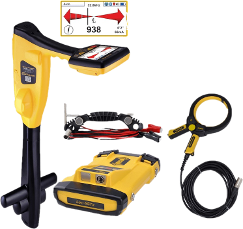
Utility Locates
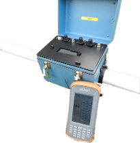
GPR
TDEM
Metal Detector
CCTV
FDEM
Applications and Solutions
Non-Metallic Pipe Position & Diameter Estimation
Pipe Depth Estimation
Sanitary Mapping
Sewer Mapping
Oil Distribution Pipe Mapping
Water Well & Piping Mapping
Buried Conduit Mapping
Computer Aid Drawing and Sketches
Communications Locates
Electric Locates
Fiber Optic Locates
Gas Locates
Pressure Steam Locates
Telephone Locates
Water Locates
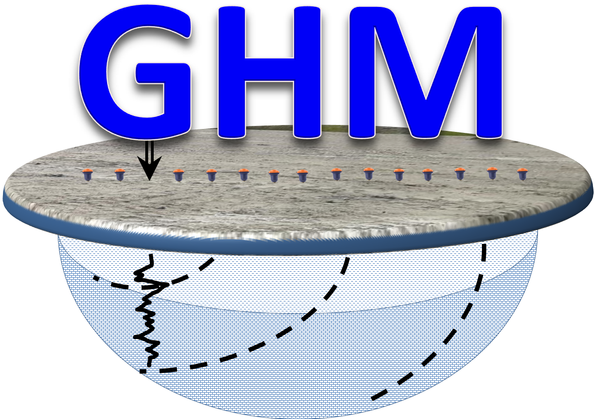
The use of non-destructive techniques such as Electromagnetic Induction Locates, GPR and Time Domain Electromagnetics for Quality Level B, C and D assessment in Utility Mapping applications guarantees several benefits to the project, including monetary losses due to utility damages, construction delays, risk mitigation and improving the public safety in general. For an efficient identification, mapping, marking and drawingof subsurface utilities, Geophysics HM Ltd adheres and follows the Standard Guideline for the Collection and Depiction of Existing Subsurface Utility Data ( ASCE Standard 38-02) and the CSA Standard S250 released in 2011 by the Canadian Standards Association (CSA).
Quality Level A
In this level the utilities are exposed for acquiring accurate measurements of the depth, position, diameter and direction of the utility. This is the most accurate level and usually is done by intrusive testing using Hydro-Vacuuming machines, hand digging,excavation or trenching. The ACAD maps created also include information on the type of the utility, material and condition.
Quality Level C
The information collected on the utilities for this level refers to the location of the utility indicators visible at the ground surface such as eclectic poles, transformers, water valves, manholes for posterior locates and mapping of the investigated utilities. This information is essential for confirming the records and documents provided in QualityLevel D.
Quality Level B
In this level, the information on the buried utilities is obtained by using induction locating techniques and surface geophysical mapping methods such as GPR and Time Domain Electromagnetics. The used techniques should accurately provide the horizontal position, extent and depth of the investigated utilities according to the required survey precision.
Quality Level D
This is the initial level for Subsurface Utility Mapping and covers the analysis of existing utility records and recollection of verbal information from the utility owners or facility operators in the investigated project site. This information is usually required for survey planning and work scheduling.
 Geophysics HM